01 — Solutions
A race course map for runners and spectators
A race course map has two audiences: runners who want the route and the water points, and spectators who want to know where to stand. STUMaps draws your course — from a 5K to a marathon route map — on real streets for both.
02 — The problem
What goes wrong on race day
- The course is an image on the website, without distances or street names.
- Spectators do not know where or when to see their runner.
- Runners cannot find their corral, the bag drop or the nearest tram stop.
- A course change or extra water point needs to reach everyone fast.
03 — The fix
How the map fixes it
Your course on a real street map, with every point that matters on race day.
- Courses with their measured length, kilometre marks and direction arrows.
- Start corrals, waves, bag drop, water, medical, toilets and spectator spots.
- Walking routes from public transport to the start and between spectator spots.
- Alerts to every open map, for example an extra water point on a hot day.
04 — Features
Features for races
-
Course switch
5K, 10K or more, each with its measured length.
-
Kilometre marks
Every kilometre and the direction of the course.
-
Course points
Water, medical, toilets and spectator spots on the route.
-
Runner view (simulated)
In the demo: a runner’s position from pace and where to see them.
-
Getting there
From the tram stop to the start on foot.
-
Race alerts
Heat, course changes or delays on every open map.
05 — Demos
Try it on Noctara Run
A fictional 5K and 10K night run on real Kraków streets, with a simulated runner to follow.
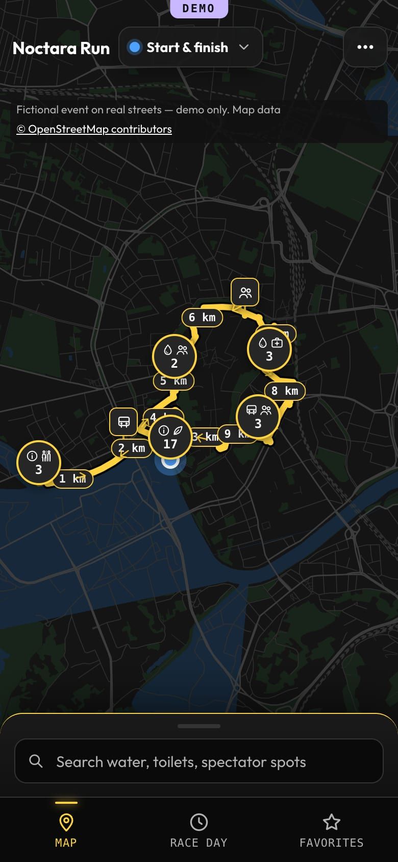
Fictional event on real streets — demo only. Map data © OpenStreetMap contributors
- Switch between the 5K and the 10K
- Open runner 1042 and follow them (simulated)
- See where to watch the runner pass
- Walk from a tram stop to the start
06 — FAQ
Questions
Can the course be drawn on real streets?
Yes. The street map comes from OpenStreetMap and the course follows real streets, with its length measured along the line.
Is live runner tracking included?
The demo shows the runner view with a simulated position from pace. Live positions need timing data from your timing provider; ask us about your setup.
Does it work for a marathon?
Yes. A marathon route map works the same way as a 5K: kilometre marks, points along the course and walking routes for spectators.
What about the street map offline?
Tiles along the course are saved after the first visit, so the course stays visible when the network is busy.
Organizing a run?
Send the course and the race-day plan — you will get an answer with what your course map would take.